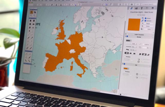
US-Australia-based developer, Mapdiva has announced their release of Ortelius 2 creative map design software for the Mac.
Serving as a hybrid between a vector drawing program, and a geographic information system, Ortelius is a professional-level vector drawing program for producing publication-quality maps. Ortelius adds tailored functionality for cartography, such as connectable track tools, powerful style engine, library of expert styles and map symbols, robust templates and so much more.
Ortelius offers three workflows for map-making:
1. Design hand-crafted maps using expert styles, symbols, and special cartography drawing tools.
2. Create maps from beautifully designed world, regional and country templates to customize and make your own.
3. For advanced users, build maps from shapefiles as a starting point for your next creation.
"We've modernized Ortelius top to bottom," say geographer and co-founder, Dr. Jill Saligoe-Simmel, "from under-the-hood performance to forward-facing features like connectable tracks and automatic junctions." For Mapdiva's more advanced users, Ortelius 2 includes the highly-requested ability to align layers when importing georeferenced shapefile map data.
Ortelius uses layers to organize your map's content. Draw roads on a roads layer, rivers on another layer, points of interest on another, and view them all stacked together. Layers are expandable and can be easily reorganized.
From cased (think double-line) roads to patterned fills, Ortelius' powerful style engine lets you build expert stacked styles which can be as simple or complex as you desire. It comes with a library of over 1800 pre-built styles and map symbols, and these can be copied or cloned to use as a starting point for your own creations. Since it's a full-fledged vector drawing program, you can even create your own graphics and map symbols, and save them to your user library to use again with future projects. Ortelius' workflows are thoughtful and efficient, and features like 'Global Styles' let you quickly make changes across multiple objects at once.
Importantly, Ortelius lets you draw to scale. For example, 1-inch on your drawing canvas can equal 1-ft or 1-mile/km on the ground. That's perfect for maps, landscape plans, floorplans and even technical drawings. Beyond crisp maps and graphics, it also has the ability to import and edit raster images. You can export vector PDF and a variety of image formats at a multiple scales and resolutions. Export your entire map, portions of the map in "slices", individual layers, or selected objects.
Ortelius 2 is available today from Mapdiva.com for $149.99 (USD)/yr annual license or $399 (USD) perpetual license. It is made exclusively for MacOS. A free trial, get started videos, tutorials and multi-lingual user guide are available on their website.
Ortelius 2 - Pro Map Design Software for the Mac

